Assets Geolocation Map
Available since version 3.1.0
This feature is AEM 6.2+ ONLY!
Purpose
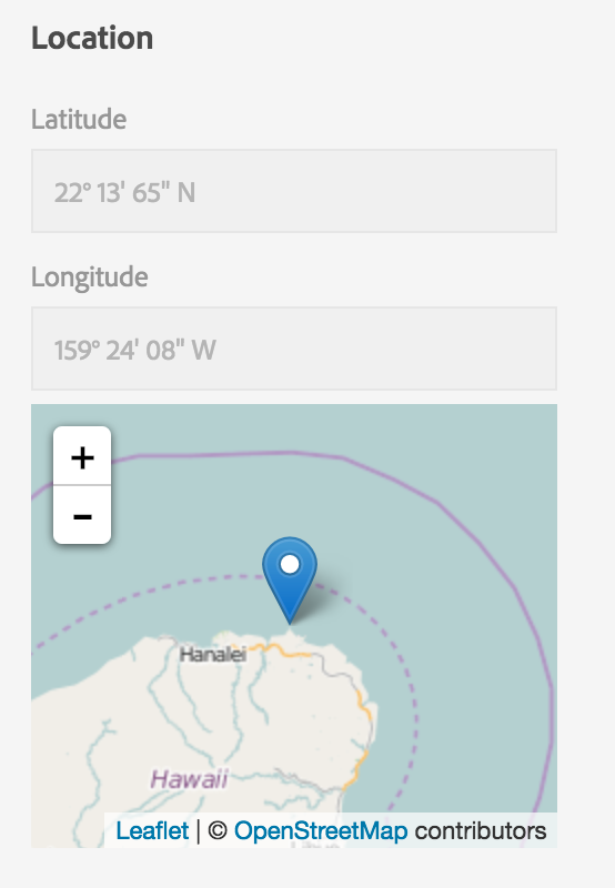
Provide a way to rewrite the values in the exif:GPSLatitude and exif:GPSLongitude metadata fields from their stored notation (DD,MM.SS[NEWS]) to the more user-friendly DD° MM' SS" [NEWS] view.
Provide a visual map in the Assets metadata editor view, powered by OpenStreeMap via the Leaflet (http://leafletjs.com/) JS library.
How to Use - Location Properties (Note that is NOT for the Map, the How to use the Map is below)
To configure the display JavaScript bit, you need to add
wrapperClass=acs-dam-location-degrees
To the metadata field definition for exif:GPSLatitude and exif:GPSLongitude
How to Use - Map (since 3.2.0)
This component can be automatically activated in the metadata schema editor.
To do this, it is first necessary to activate an OSGi component which handles the activation. To do this, create a new node named com.adobe.acs.commons.dam.impl.CustomComponentActivatorListServlet of type sling:OsgiConfig in any valid config folder in the repository.
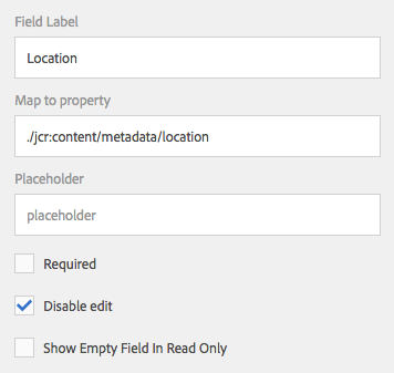
Then create a new textfield component in the Metadata Schema Editor and specify a “Map to property” of ./jcr:content/metadata/location and ensure the field is disabled. This field will be automatically replaced with the map component when the asset editor is loaded.
- Download the AEM Content Package that installs the required Wrapper Client Libraries and activates the CustomComponentActivatorListServlet.